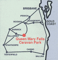
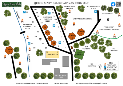
Directions to get to Queen Mary Falls Caravan Park
Check www.QLDtraffic.qld.gov.au or phone 13 19 40 for road traffic conditions.
DO NOT FOLLOW YOUR GPS in the night/dark due to wildlife and steepness
Option one – if towing anything or a motorhome, and coming from the Coast or Brisbane
This is the only way to come to our park if you are towing anything via the Cunningham Highway and Cunningham’s Gap. Just past the top of “the gap” there is a Service Station on the left, approx 21klms past that you will see a brown tourist sign saying Queen Mary Falls, Freestone, Freestone Road to the left.
The first town is Freestone and just past Freestone the sign reads Queen Mary Falls, turn left, then follow all the signs to Queen Mary falls or Killarney Falls or Killarney. You will go through small towns Yangan, Emu Vale and Tannymorel. Once you are at Killarney, we are well sign posted, continue through Killarney approx 4 kms on the other side of Killarney the sign will say “The Falls Drive”, Spring Creek Road and Boonah. Once you turn left here you will see we are about 6 kms up the mountain, it’s not steep or narrow, it doesn’t have any hair pin bends it’s just a continual climb.
Option two – if not towing and coming from the coast
DO NOT FOLLOW YOUR GPS in the night/dark due to wildlife and steepness
The other way if not towing anything is via Boonah. This road does take you up a very steep, narrow and winding road that is all bitumen. Although a very slow drive it’s very beautiful.
At Boonah’s roundabout take the Boonah-Rathdowney Road, follow for approx 15kms, then right into Carney’s Creek Road follow for approx 15kms, then right into The Head Road, or The Falls Drive you will start the climb up the two mountains approx 10klm on, this road will turn into Spring Creek Road at the top of the first mountain, climb the 2nd mountain and at the top is Carr’s Lookout, follow for a further 8kms and we are on the left hand side.
It takes approx 1 hour from Boonah to us.
Also keep an eye out for Queen Mary Falls signs.
Option three, towing or not – if coming from Warwick
Turn at the Killarney sign, off the New England Highway on the Stanthorpe/ southern side of Warwick, this is the Killarney Road, follow all the way approx 30kms to Killarney then follow all the signs to Queen Mary Falls and then as above in Option one**.
Coordinates 28 degree 20.556 South 152 degree 22.266 East


